NASA scientists have created a two-minute animated tour under the
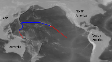
Pacific Ocean, based on real data about the sea floor's peaks and valleys. Submerge near Hawaii, run like a submarine to Japan, and finally dive to the ocean's deepest point, between Japan and New Guinea.
courtesy of Gene Feldman and Dave Pape, NASA
Map showing above water (red) and undersea (blue) flightpath

![]() Click on the images above or the list below to see mpeg animations of some of the segments of the actual flyby.
Click on the images above or the list below to see mpeg animations of some of the segments of the actual flyby.
![]() Ocean Planet Exhibition Floorplan
Ocean Planet Exhibition Floorplan
![]()