 The 1-km resolution AVHRR images may provide a daily synoptic view of
the Florida Bay area and therefore may have the potential to depict the
areal extent and location of the discolored water patches on days that
biologists are not in the field.
The 1-km resolution AVHRR images may provide a daily synoptic view of
the Florida Bay area and therefore may have the potential to depict the
areal extent and location of the discolored water patches on days that
biologists are not in the field.
The 1-km resolution AVHRR images may provide a daily synoptic view of
the Florida Bay area and therefore may have the potential to depict the
areal extent and location of the discolored water patches on days that
biologists are not in the field.
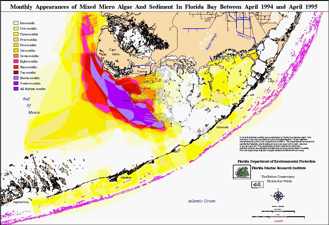
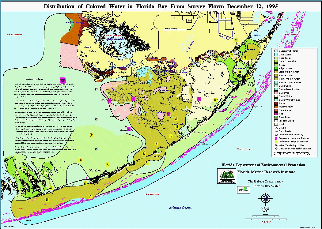
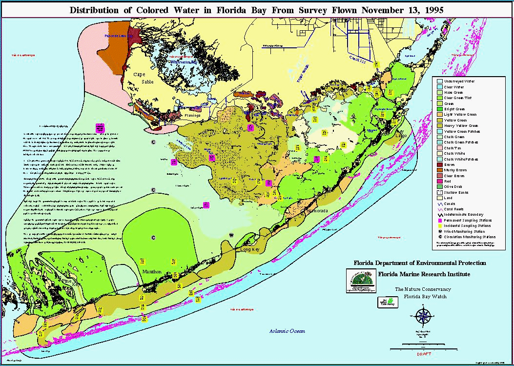
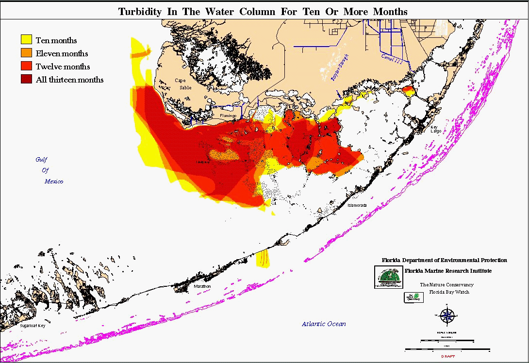
Monthly aerial surveys are used at the Florida Marine Research
Institute to map the distribution and extent of turbid water masses in
Florida Bay. Water samples are collected and analyzed from around the
Bay to determine the composition of the major water masses. Based on
the results of these analyses, the original 19 classified colors are
summarized into 5 groups of turbidity.
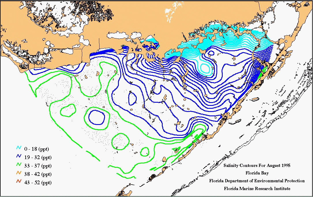 Surface salinity levels are, in part, controlled by rainfall and
land-management practices. As an environmental parameter, salinity
levels in turn affect the distribution of marine flora and fauna.
Salinity levels were collected over a period of several weeks by
Florida Marine Research Institute scientists.
Surface salinity levels are, in part, controlled by rainfall and
land-management practices. As an environmental parameter, salinity
levels in turn affect the distribution of marine flora and fauna.
Salinity levels were collected over a period of several weeks by
Florida Marine Research Institute scientists.
![]()
![]()
JASON Project homepage ||
Teachers' Guide ||
Students' Corner ||
Search
Gene Carl Feldman
(gene@seawifs.gsfc.nasa.gov)
(301) 286-9428
Todd Carlo Viola, JASON Foundation for Education (todd@jason.org)
Revised: 23 Jan 1996